Knowing The Road

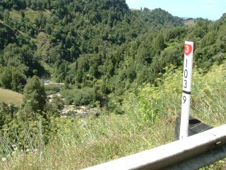
This marker peg overlooking the Mangaotaki River has the secret markings of the Fluro vested brotherhood inscribed on it.
At the risk of being drummed out of the regiment, and losing my tar allowance I am about to make them public knowledge.
One of my more promising students can easily explain them.

Got It?
The State Highways are divided into Block Sections.
They usually begin and end at a geographical feature, or major intersection.
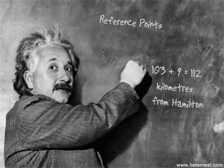
So this peg is in the 103 block section which started 103km's from Hamilton, the beginning of State Highway 3
Everything is described on the road from looking south.
"True Left" is left looking south. The pegs are on the true left. Every kilometre.
We can roughly calculate smaller distances by counting the spaces in the centre line (10 metres) though some vehicles have special trip meters.
So if I am sent to 103/9.420 I can find the long lost pothole.
If I remembered to write it down ...
Labels: navigation, road position


<< Home