Rest Area 300m

Tuesday, February 28, 2006

Knowing The Road


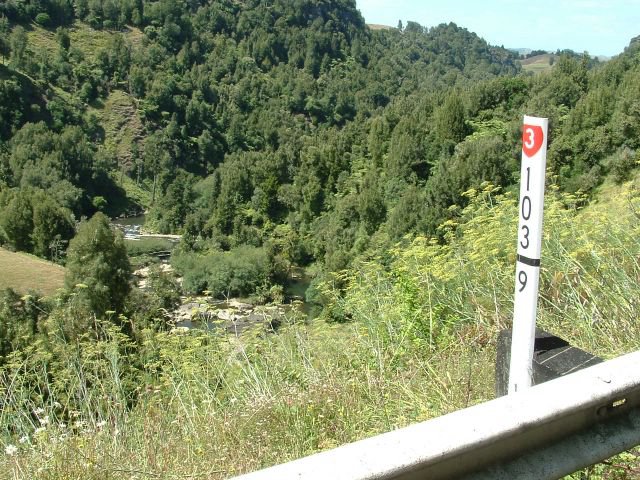
This marker peg overlooking the Mangaotaki River has the secret markings of the Fluro vested brotherhood inscribed on it.

At the risk of being drummed out of the regiment, and losing my tar allowance I am about to make them public knowledge.

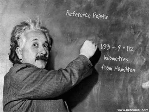
One of my more promising students can easily explain them.
Got It?

The State Highways are divided into Block Sections.
They usually begin and end at a geographical feature, or major intersection.
So this peg is in the 103 block section which started 103km's from Hamilton, the beginning of State Highway 3

Everything is described on the road from looking south.
"True Left" is left looking south. The pegs are on the true left. Every kilometre.
We can roughly calculate smaller distances by counting the spaces in the centre line (10 metres) though some vehicles have special trip meters.
So if I am sent to 103/9.420 I can find the long lost pothole.

If I remembered to write it down ...

Labels: ,

Thursday, March 17, 2005

Knowing The Road.

The most confusing thing for a newbie road worker is learning the road. You may be sent to "Marmonts" " Truckies" "The Jesus Rock" or "Paycart Corner". We have 200 kilometres to look after, and you may think you know the road fairly well, but you have to get to know it intimately, - after a couple of years I'm just getting to grips with it. Most corners, or places, are named from people who live, or have lived there, often years ago. We have a system of marker pegs which can pin point a place on the road. They are every 1 kilometre, and within a "block section". The 103/4 peg is 103 + 4 kilometres from the beginning of State Highway 3 in Hamilton. You can then get down to the nitty gritty by counting the white lines in the middle of the road (10 metres apart) or using a rally trip meter. The usual method though would be a description. " This side of Marmonts, up from the Amco (barrier), where the culvert into the paddock is..... "
Some of the names are very old. I asked about "Paycart", it seems that in the old days that was where the men would gather to get their wages in cash. It was a handy spot for those who had to come down from the back roads, or across the river, and was just up the road from the pub. "Truckies Corner" was nick named that for the number of trucks that went off the road or fell over there, until the camber was fixed and realignment work done. The "Jesus Rock" was so called for the "Jesus Saves" graffitti painted on it. "Downers Cutting" for the firm that made it. Each corner or section of the road has a story, the old guys can tell you who made each corner or cutting, and what they used. They will tell you of parties, fights, drunken grader rides, and bulldozers hurtling over bluffs, of slips that closed the road for days, of fires and floods. I've already got a wee bit of the road, "Where your truck fell over".

Labels: ,

Male. Lives in New Zealand/North Island/The Road, speaks English. Eye color is blue.
This is my blogchalk:
New Zealand, North Island, The Road, English, Male.

Who Links Here eXTReMe Tracker